Shoal Harbour
Appearance
You can help expand this article with text translated from the corresponding article in Dutch. Click [show] for important translation instructions.
|
Shoal Harbour | |
|---|---|
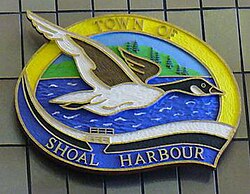
 A wood carving of the town seal of Shoal Harbour on display at Memorial University of Newfoundland | |
| Coordinates: 48°11′N 53°59′W / 48.183°N 53.983°W | |
| Country | |
| Province | |
| Census division | Division No. 7 |
| Elevation | 0 - 74 m (0 - 243 ft) |
| Lowest elevation | 0 m (0 ft) |
| Time zone | UTC−4 (AST) |
| • Summer (DST) | UTC−3 (Atlantic Daylight Saving Time) |
| Area code | 709 |
| Telephone Exchange | 643, 283, 214, 649, 641 and 721 |
Shoal Harbour is a small community in Newfoundland and Labrador, Canada.[1] It is part of the Town of Clarenville and just north of Clarenville proper.
See also
[edit]References
[edit]- ^ "Search the Canadian Geographical Names Database (CGNDB)". Government of Canada. 2021-02-16. Retrieved 2024-12-01.
48°11′N 53°59′W / 48.183°N 53.983°W

